Subscribe and receive email notifications of new blog posts.
 RSS Feed
- 2026 | 26 Posts
- 2025 | 48 Posts
- 2024 | 48 Posts
- 2023 | 48 Posts
- 2022 | 48 Posts
- 2021 | 48 Posts
- 2020 | 48 Posts
- 2019 | 48 Posts
- 2018 | 50 Posts
- 2017 | 52 Posts
- 2016 | 34 Posts
29
Relocating to the Wright-Patterson Air Force Base Area
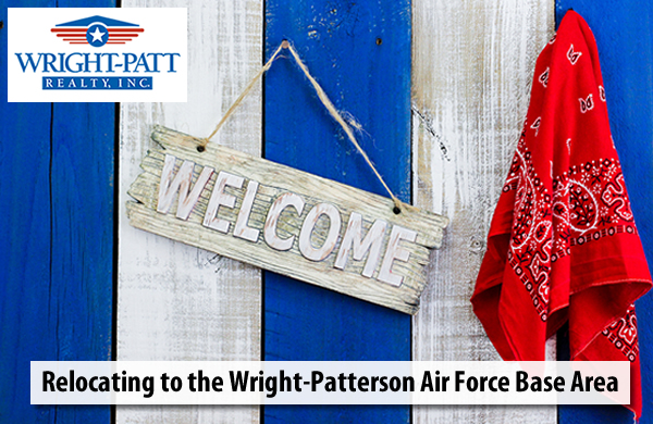
Thinking of moving to the Wright-Patterson Air Force Base area? Well, the good news is that there are lots of things to do AND this part of Ohio is truly beautiful! Western Ohio features a low cost of living and has many natural amenities that all help contribute to a very high quality of life.
But, first things first. Let's get you acquainted with the area. The Wright-Patterson area includes the following towns and cities:
- Beavercreek
- Bellbrook
- Centerville
- Enon Village
- Fairborn
- Huber Heights
- Kettering
- Oakwood
- Riverside
- Springboro
- Washington Township
- Xenia
- Yellow Springs
Explore the links above to try and get a feel for which town will fit you and your family the most.
Community Resources
Picking up and moving from one place to another is a huge inconvenience, especially when kids, pets etc. are involved. Knowing who to contact will help you immensely. Check out these handy resources for the Wright-Patt AFB area.
County History
This part of the buckeye state consists of Clark, Greene, Miami, Montgomery and Preble counties, which were all settled in the early 1800s. Clark County was named after George Rogers Clark, who was a hero of the American Revolution. It was originally part of Greene, Champaign and Madison counties. This county began to flourish during the 1830s, with the completion of the National Road that ran through Ohio.
Greene County was named for Gen. Nathanael Greene, an officer in the Revolutionary War. In 1818, a small amount of territory was taken from Greene County to form Clark County. Greene County's territory has remained the same ever since that time.
Miami County residents named the county in honor of the Miami Indians. Previously, the county had been part of Montgomery County. The county seat is Troy and it is part of the Dayton Statistical Area. Much of the area is rural, with less than 4 percent of the county's 407 square miles consisting of urban areas.
Montgomery County was named in honor of Richard Montgomery, an American Revolutionary War general killed in 1775 while attempting to capture Quebec City, Canada. Dayton is the county seat and Montgomery is the fifth most populated county in the state. Montgomery County flourished during the 19th century. With the completion of the Miami and Erie Canal in 1829, Dayton was then connected to Cincinnati.
Preble County was formed from portions of Butler and Montgomery Counties. It was named after Edward Preble, a naval officer who fought in the American Revolutionary War and against the Barbary Pirates.
Weather and Climate
The climate in much of Ohio is hot and muggy in the summers and cold and dry in the winters. Low humidity and cool nights and mornings give relief from higher summertime temperatures. In Dayton, the warmest month is July, with an average high of 84 degrees and an average low of 65 degrees. The coldest month is January, with an average high of 35 degrees and an average low of 20 degrees. Precipitation in Montgomery County is average compared to the rest of the nation. Most precipitation falls spring months, and average yearly rainfall is about 40 inches.
Let Wright-Patt Realty Help You
If you are planning your move to the Wright-Patt area, let us help you find your dream home! Feel free to contact us and we will be happy to help! You can also sign up for your FREE portfolio file. Just input your housing criteria and get new listings sent to you daily!